MAP PORTFOLIO
Photorealistic
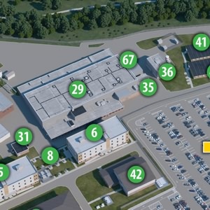
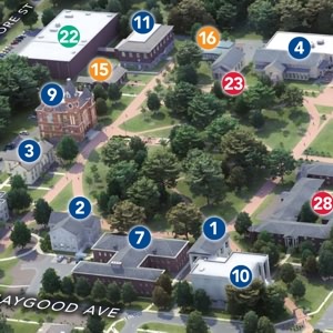
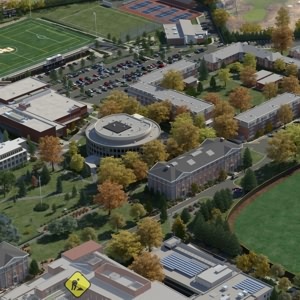
Photorealistic maps can sometimes trick their viewers into wondering if they are looking at an actual photograph! Created using a combination of Trimble SketchUp, Blender and a handful of other tools, these maps are somewhat similar to their "3D Raster" cousins! Only the illustrated detail, color, and lighting/shading is taken to the next level.
Showing 1-12 of 12
![](https://mapformation.com/wp-content/uploads/2022/05/Bettis-map-w-labels.jpg)
![](https://mapformation.com/wp-content/uploads/2022/05/kilgorecollege.jpg)
![](https://mapformation.com/wp-content/uploads/2022/05/NCS_Composition-Comp.jpg)
![](https://mapformation.com/wp-content/uploads/2022/05/cbhs.jpg)
![](https://mapformation.com/wp-content/uploads/2022/03/oxford3Demory.jpg)
![](https://mapformation.com/wp-content/uploads/2022/03/villanova.jpg)
![](https://mapformation.com/wp-content/uploads/2022/03/sbc.jpg)
![](https://mapformation.com/wp-content/uploads/2022/03/nova3Dct.jpg)
![](https://mapformation.com/wp-content/uploads/2022/03/hampton.jpg)
![](https://mapformation.com/wp-content/uploads/2022/03/centralmichigan3Dct.jpg)
![](https://mapformation.com/wp-content/uploads/2022/03/adelphi3Dct.jpg)
![](https://mapformation.com/wp-content/uploads/2016/10/coppinstate3D.jpg)